The gap between marketing and letting commercial space is often measured in months. A landlord with a well-presented suite at a competitive rent shouldn't be losing three months to back-and-forth scheduling — but that's the reality when the only way to assess a space is to book a viewing. Decision-makers at prospective tenants — the managing director, facilities lead, and finance director — rarely align diaries easily. Many aren't even in London. A 360° virtual tour changes that dynamic. Prospective occupiers can walk through a space on their own timeline, qualify it against their brief, and arrive at an in-person viewing having already made 80% of their decision.
Quick takeaways
- A 2022 analysis found only 4% of UK property listings include a virtual tour — commercial landlords who do are a clear minority, and stand out accordingly (Giraffe360, 2022)
- One scan session delivers 360° tour, floor plans, and LiDAR point cloud — useful for leasing, FM records, and refurbishment planning
- Floor plans generated from scan data are accurate to 20mm — suitable for desk counts, fit-out feasibility, and space planning
Why remote viewings work differently for commercial tenants
Commercial property decisions involve more stakeholders than residential. The person who found the space isn't the person who approves the lease. That creates a problem: getting the right people to the same property at the same time, when those people might be spread across multiple offices, cities, or countries.
A virtual tour solves the stakeholder alignment problem. The agent shares a link. Decision-makers review the space on their own timeline. The tour handles the initial qualification round — and by the time an in-person visit is scheduled, everyone has already formed a view.
A 2022 analysis of live UK property listings by Giraffe360 found that only 4% of homes and commercial units listed for sale were marketed with a virtual tour. For landlords and agents who do include one, that scarcity is an advantage — a listing with a virtual tour stands out rather than blending in. According to Matterport's own published research, properties with virtual tours receive 49% more qualified leads, meaning those who do enquire have already pre-qualified themselves. For commercial property — where a wasted viewing might involve coordinating access to a vacant building with multiple attendees — reducing low-intent viewings has direct operational value.
The benefits of virtual tours in commercial property marketing
The benefits of virtual tours for commercial properties go beyond stakeholder convenience. Property virtual tours reach a broader audience than physical property viewings ever can — an investor in Singapore or a relocating team anywhere in the world gets the same complete 360 degree view of the space as someone who walked in. Virtual tours allow potential buyers and tenants to explore properties at their own pace, returning to specific aspects of the property — the lift lobby, the comms room, the shared amenity floor — as often as they need. Static images can't do that; an immersive tour with interactive elements gives serious prospects a far better user experience, and it shows in the enquiry quality.
For agents marketing commercial property, the practical wins: virtual viewings save time for everyone, listings with 360° virtual content stand out on portals and social media platforms, and tours forwarded by email do the first qualification round automatically. Every type of commercial space benefits — office buildings and commercial office suites, retail units, industrial and warehouse space — and for office spaces in particular, prospective tenants can test office layouts against the floor plan before a single site visit. Incorporating virtual tours into your commercial real estate marketing strategies is one of the few moves that improves reach and reduces cost at the same time: fewer wasted journeys is also a small, genuine ESG win.
Platforms and technology: Matterport, 360 photography and digital twins
Creating a virtual tour for commercial real estate comes down to three routes. Matterport built the category — its 3D digital twin product produces the familiar dollhouse-style 3D models and 3D walkthroughs, with hosting on a monthly subscription. Standard 360 photography tours are cheaper but capture lower-resolution panoramas without measurable data. See3D's approach combines the strengths: high-resolution 134MP capture with LiDAR, the high-quality immersive experience of 3D tours, dimensionally accurate floor plans, and permanent hosting without the subscription. A modern virtual tour should also integrate where your audience already is — embedded in property listings, linked from Google Maps via your Business Profile, and viewable in virtual reality (and increasingly augmented reality) for occupiers who want to walk the space from another city. Whichever route you take, choose a virtual tour company that delivers professional virtual tours with the data layer included — integrating virtual tours into your property marketing only pays off if potential clients can trust what they see enough to close deals faster.
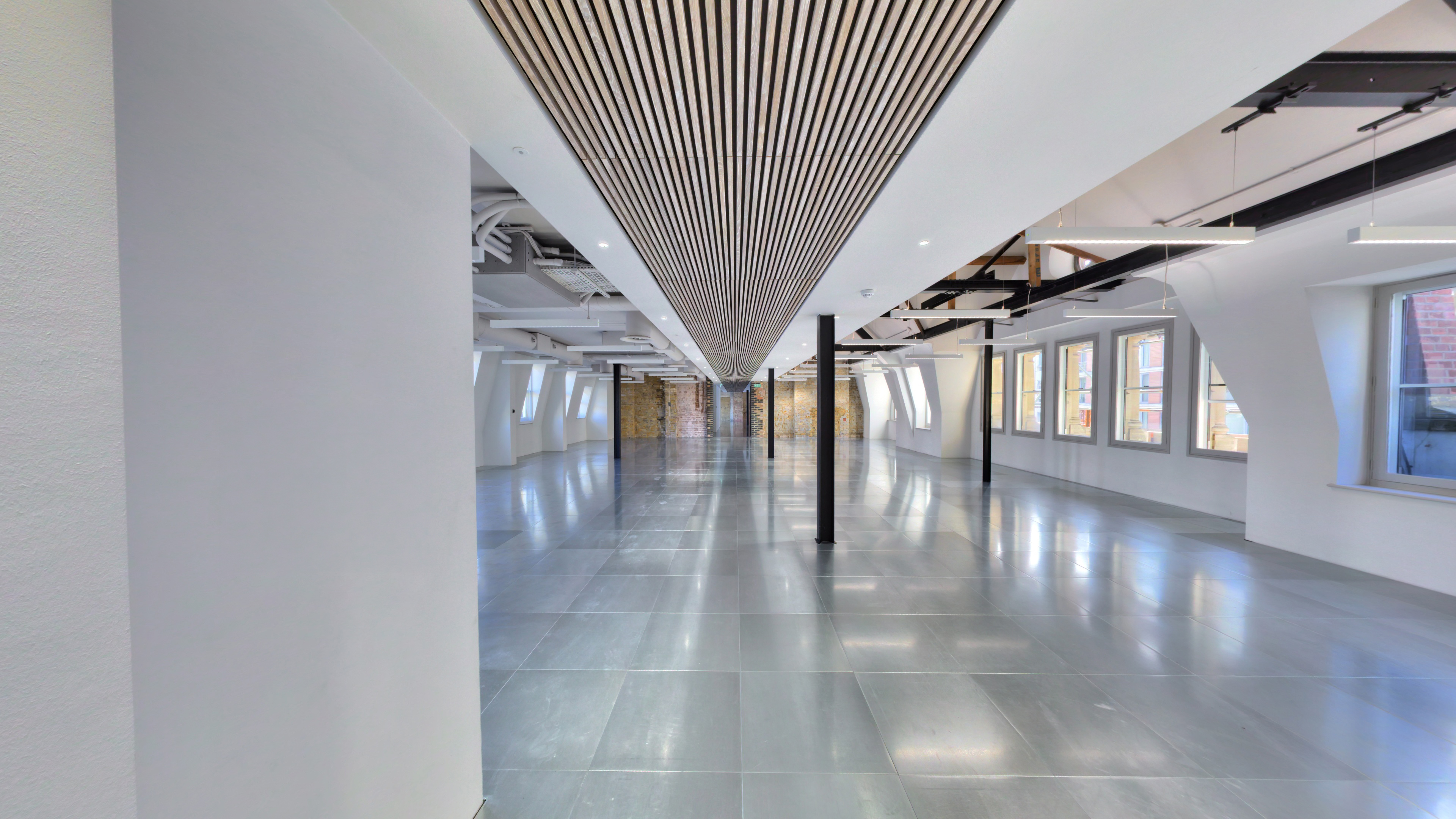
What a commercial 360° tour includes
A standard commercial tour covers the lettable floor area from scan positions that give an accurate read of scale, natural light, and configuration. For larger or multi-floor buildings, the scan extends to each floor and includes relevant shared areas — lobbies, lift cores, welfare facilities.
From a single scan session, you receive:
- Hosted tour link — shareable directly, embeddable in your listing, with no recurring fee options available
- Embed code — for Rightmove Commercial, CoStar, your own website, or your agent's platform
- Floor plans — to PDF and DWG, generated from scan data rather than manually drafted
- Optional LiDAR point cloud — .las, .e57, or .rcp files for fit-out planning, FM records, or technical due diligence
Floor plans generated from scan data are dimensionally accurate. For prospective tenants who need to run a desk count or test a fit-out hypothesis before committing, that removes one of the earliest friction points in the letting process.
Before the scan: what to prepare
Commercial spaces scan well whether vacant or occupied. A few things are worth arranging beforehand:
Lighting: Turn on every light in the space. In offices with glazed facades, check whether direct sunlight is creating strong contrast — early morning or overcast days often give cleaner results than midday bright sun.
Clearance: Remove temporary items that will date the tour — personal belongings, ad-hoc storage, contractors' materials. A CAT A space photographs best when it reads as lettable, not in-progress.
Back-of-house: Decide upfront whether you want plant rooms, service areas, or roof terraces included. These add scan time but can be useful for technical tenants evaluating the building's infrastructure.
Access coordination: For occupied buildings, scanning in evenings or at weekends avoids disrupting existing tenants. Most commercial scans complete in a single session.
Beyond leasing: FM records and fit-out planning
The same point cloud data that generates your floor plan also has a second life. Facilities management teams increasingly maintain digital records of their buildings — a LiDAR scan of each floor produces a permanent, accurate reference useful for maintenance planning, asset tagging, and contractor briefing without repeated site visits.
For refurbishment projects, the point cloud is the starting point. Rather than beginning a CAT B fit-out from drawings that may be decades out of date, a fresh scan confirms existing conditions with 20mm accuracy. Architects and project managers can work from that data directly — and the scan typically pays for itself in avoided rework.
What you receive on delivery
Once scanning is complete, processing and delivery takes 3–5 working days. You receive a live tour link for immediate sharing, an iframe embed code for your listings and website, floor plans in PDF and DWG, and optional raw point cloud files (.las, .e57, .rcp) for technical use.
Hosting is flexible. See3D offers options including permanently hosted tours with no recurring fees — your marketing asset stays live as long as you need it, without a subscription renewing in the background. Every scan is handled personally, with no outsourcing.
Get in touch to request a quote for your commercial property — we'll respond with a tailored proposal based on your floor plan and scope.
Sources & references
- Giraffe360, May 2022. "Only 4% of homes listed for sale in the UK were marketed with a virtual tour." introducertoday.co.uk